Agriculture to Airfield
A History of Middle Wallop Airfield up to 1939 - Part 1
Today, the Army Aviation Centre is situated on chalk downland, straddling the Salisbury-Andover Road (A303) with the larger portion of the site occupying the southside. The airfield is broadly bounded by the villages of Over Wallop, Nether Wallop and Kentsboro, with Middle Wallop being a more of a postal area. The airfield itself spans both the parishes of Over Wallop and Nether Wallop.
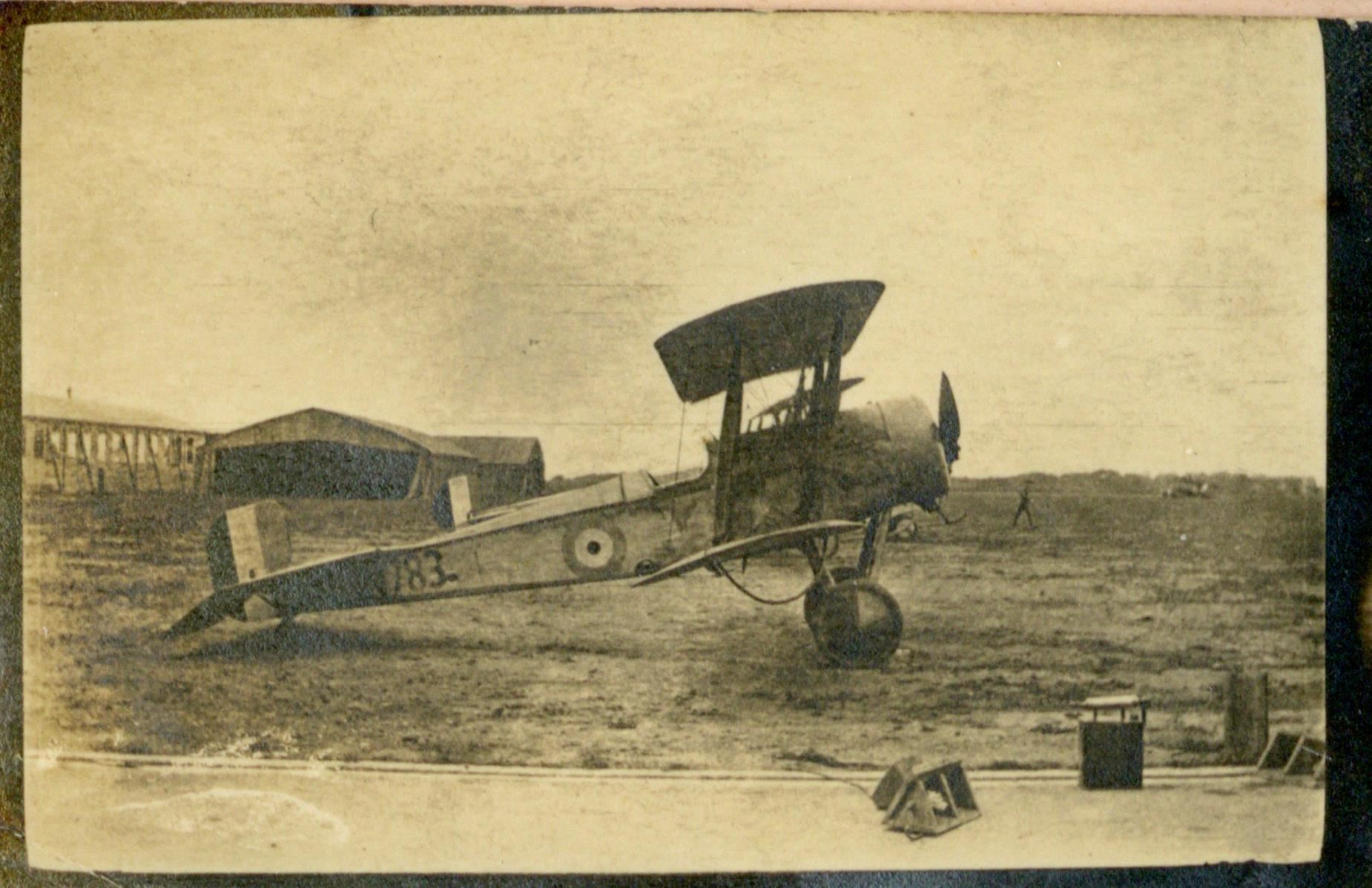
For most interested in the history of Middle Wallop Airfield, that history begins in 1935 with Germany’s declaration of rearmament in violation of the Treaty of Versailles. This prompted the Royal Air Force to embark on a series of expansion plans across the UK and the Wallops were ideally situated for an airbase, being relatively flat and close to the coast. The lands were acquired under the ‘Acquisition of Land Act’, 1919. On Monday 12 September 1938, the site officially became Air Ministry property when Mr O. L. Clay, the Clerk of Works, arrived at the site ready for duty.
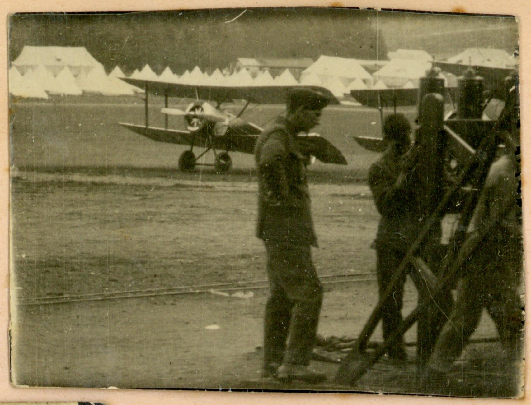
Aircraft flying over the Wallops was, however, nothing new. With the birth of British Aviation at Larkhill, in 1910, 10 miles north-west, airfields popped up at Netheravon, Upavon, Andover, Old Sarum, Boscombe Down, Stonehenge, Lopcombe Corner, and Chattis Hill. These were all within a 15-mile radius. During the later years of the First World War aircraft were seen frequently over the Wallops:
‘In 1917-19, the stunt flying over the wallops was great fun…pilots who lived in the village (Nether Wallop) used to land in the fields around…while they went home to breakfast, lunch or tea’
– J. B. Dacre, resident of Nether Wallop village, AFM Archive Collection
There is however a less explored history. For thousands of years prior to the Wallops hosting aircraft, it was fertile agricultural land that was farmed and shaped by those who owned, worked, and lived on it.
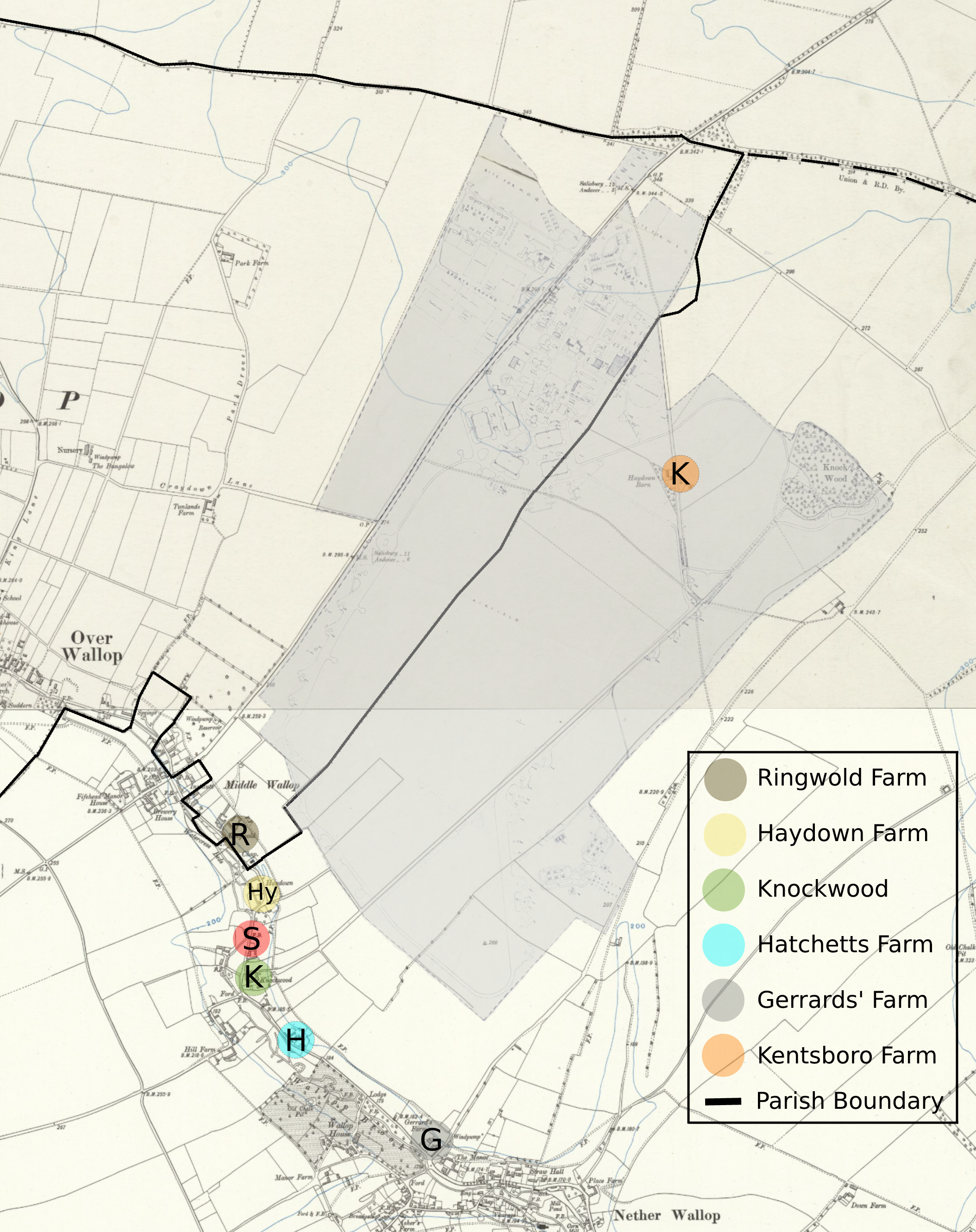
The airfield land had originally belonged to several properties in the surrounding villages. The map above shows the parish boundary between Over and Nether Wallop (black lines) which likely dates to the Anglo-Saxon period, or earlier. It also shows the extent of land that the Air Ministry had acquired by 1944 (grey area). It included lands (indicated by the letters) belonging to Ringwold Farm, Gerrard’s Farm, Haydown Farm, Hatchetts Farm, Kentsboro/Jury’s Farm, Knockwood Farm, and Staplewood Farm, as well as several individual houses and bungalows.
The Early History
Although we do not know much about the lands that now make up the airfield in the Prehistoric and Roman periods, we do know that it was occupied in the Bronze Age. There is evidence of Bronze Age burials, axe hoards, and post holes on the site of the present airfield. The Romans were also present in the area, with pottery found at ‘Kents’ Barrow’, and a Roman Cemetery close by.

The name ‘Wallop’ likely comes from the Anglo-Saxon word ‘wælla’, meaning spring or stream, and ‘hop’, meaning a remote valley, ‘wælla hop’. The Nether and Over additions came much later, first appearing in the 1270s-1280s as ‘Inferior’ and ‘Superior’. Kentsboro, on the other hand, has had a few different names, from ‘Kents’ Boro/Barrow’ possibly named after the soldiers from Kent who fought alongside the Saxons in the Battle of Guoloph at Wallop in the 5th Century AD, to ‘Canute’s Barrow’ presumably named after King Canute who won a battle at Bury Hill, near Andover, in 1016.
By the mid-11th century, most of the land at ‘Wallope’ belonged to King Edward the Confessor. He leased the estate to his father-in-law, Earl Godwin. What is now Middle Wallop crossroad was then a manor called Fifehead, which was held by Countess Gueda, wife of Earl Godwin, and their son, Harold, later King Harold, who held Over Wallop. After the Norman Conquest, these lands passed to William the Conqueror, who kept the majority of what is now Nether Wallop and passed the Crown lands in Over Wallop to Hugh de Port, a French-English Baron. These lands, along with some acreage in Nether Wallop, later found their way to the Earls of Portsmouth.
In 1177, King Henry II passed the Crown lands in Nether Wallop, which now consisted of three manors, to Amesbury Abbey, which is where they remained until the dissolution of the monasteries in 1534. The 7,147 acres of land (over four times larger than Gibraltar) at Nether Wallop were then passed to the Lord Chancellor, Thomas Wriothesley, 1st Earl of Southampton, in 1545. They were then sold two years later to Sir William Paulet, 1st Marquess of Winchester.
The Enclosure of Nether & Over Wallop
In 1786/7, the lands of Nether and Over Wallop were ‘Enclosed’ under the ‘Enclosure Act’. This was initiated by a petition from either the landowners seeking to increase rents on their lands or by tenants as a way of improving their farms. ‘Enclosure’ records give us the first detailed glimpse of who owned what land on the future airfield.
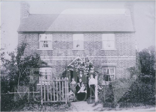
Knockwood farmhouse, which still resides in Nether Wallop today, dates to the 17th century. At the time of the enclosure, it was owned by John Wallop, 2nd Earl of Portsmouth and leased to James Saunders, Yeoman. The entire plot was called ‘Sander’s Bargain’ and extended from Knockwood farmhouse all the way up to, and beyond, Knockwood Copse (land in green on the map below).
The land in brown on the map was owned by a man named William Coles Esq who owned several other plots in the area. In the Poll Books for 1710, 1714, and 1734 there is listed a William Coles of Salisbury, Freeholder, in Over Wallop. Little else is known about William Coles other than there being an Epitaph in Salisbury Cathedral to a William Coles Esq, of ‘this Close’ who died in 1789. This is likely the man who owned the fields at the time of enclosure.
On the map below, the owners of the lands in blue are unclear and the dark blue represents the roads and trackways that once ran across the area.
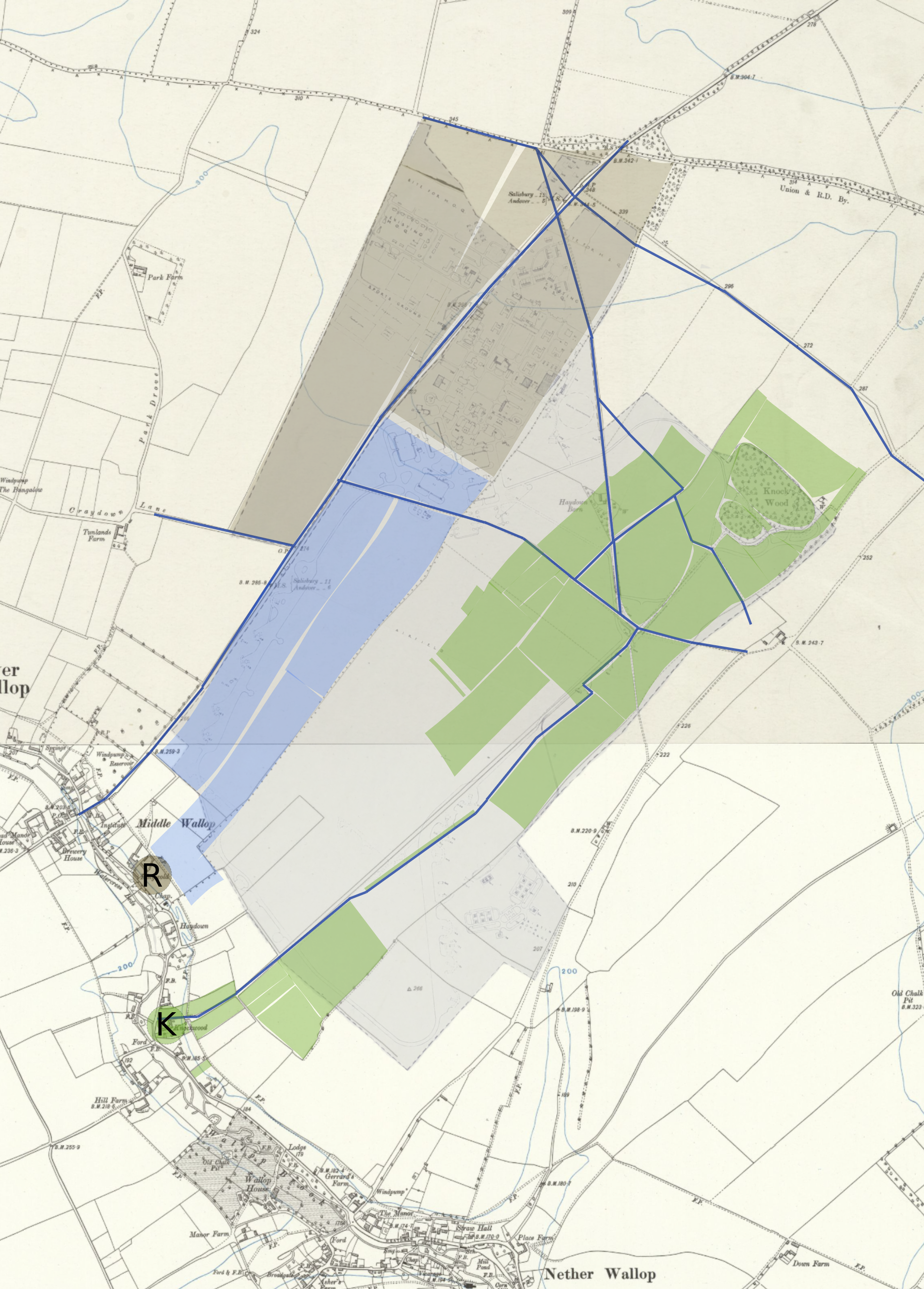
Gerrards Farm, Hatchetts Farm, Haydown Farm, and Staplewood Farm are not mentioned on the enclosure, but the buildings definitely existed by the mid-1700’s. Ringwold Farm does appear on the Over Wallop enclosure, but it is not certain who owned the property, whereas Kentsboro Farm did not exist at this time.
Around 40 years later, about half of the original 7,147 acres of land in Nether Wallop (formerly owned by Amesbury Abbey) that had passed to the Paulet family had been sold off freehold to various parties. The remaining 2,296 acres were owned by William Orde-Powlett, 2nd Baron Bolton, also known as Lord Bolton.
This is the end of Part 1 of our 'Agriculture to Airfield' blog post series. Come back again for Part 2 which looks at the purchasing of the land by the Air Ministry and the Airfield during the First World War.
Bibliography:
AFM Collection
Maynard, Behind the Scenes: A History of Nether Wallop, (Andover: Bulpitt Print, 2011).
Victoria County History, A History of the County of Hampshire, Vol. 4, ed. W. Page, [online] https://www.british-history.ac.uk/vch/hants/vol4.
Hampshire Archives and Local Studies, Documents Consulted:
H/CL5/1o/22
21M65/F7/166/2
21M65/F7/182/2
Q23/2/92/1
97M72/DD62
46M84/F67/7
46M84/F67/11
4M92/PS/77/2
H/CL7/21
4M92/PS/77/5
46M84/F67/5-6
Nether & Over Wallop Electoral Registers 1937-1939
Written by Kyle Thomason, 2022